Orogeny and landform
The Himalayan range is the result of the collision between the Indian and Asian Plate. The timing of the collision is still object of debate (Hu et al., 2016, Khan et al., 2009; Rehman et al., 2011) with estimates ranging from 100 to 40 Ma. Isostatic adjustment following the collision begun 20 Ma lifting the newly formed Himalayan batholith. The currents height was probably reached between 2.5 to 1.8 Ma (Powell and Conaghan, 1973). The isostatic movement created three main thrust lines visible in Figure 3. A geological map is shown in Figure 6. For a more detailed one refer to Phillips (2008). The region is still geologically active and has experienced earthquake as in 2008 and 2015.
The landform of Ladakh is predominantly dominated by glacial processes causing the “U” shaped valley (Figure 1) typical of the region reaching a width of 4 km near Nyoma. Fluvial activity created additional features as gorges, strath terraces, glacial outwash plains. More recently (25-17 ka) eaolian activity contributed by creating dunes and sand ramps as seen in Figure 2 (Juyal, 2014; Kumar and Srivastava, 2018).
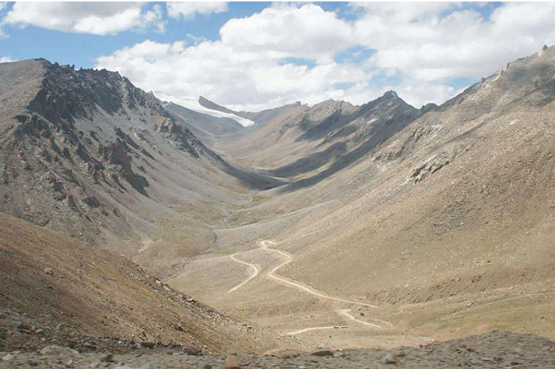
Fig.1: East-west trending glacially carved ‘‘U’’ shaped valley near Kahardung La. Note the present Kahradung Glacier sticking to valley headwall. (Kale 2014, p. 119
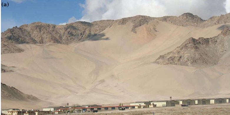
Figure 2: Obstacle dune near Leh (Kale 2014, p. 119
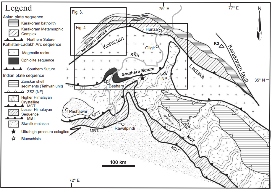
Figure 3: simplified geological map of the Northwest Himalaya showing major tectonics units of the Indian Plate, undifferentiated rocks of the Kohistan-Ladakh Arc sequence, and the southern margin of the Asian Plate ((Rehman, 2011)
Soil
Thick soil cover is limited to valley bottoms and belong mostly to Eutric Cambisoils and Lithosoils with presence of Orthic Acrisoil (Figure 4). They have a coarse grained structure, low water, high organic matter, high pH, relatively high N and P concentration. Organic matter, N, P, ammonia, nitrates increase with elevation with highest value in alpine zones and lowest in deserts (Doležal et al., 2018).
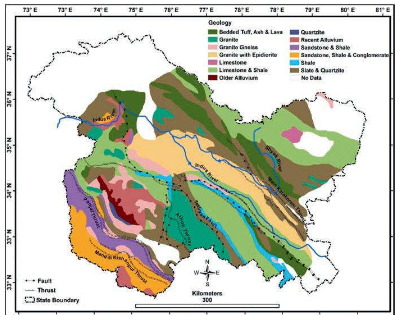
Figure 4: geological map of Ladakh and Jammu & Kashmir state ((Dar 2020,p.135)
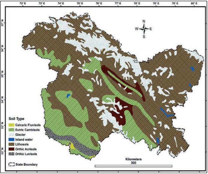
Figure 5: soil types of Ladakh and Jammu & Kashmir state (Dar 2020,p.149